Technologies

Gray's Reef National Marine Sanctuary offers a near-pristine live-bottom habitat and a testing ground for new marine technology. Marine researchers have tested new technologies at Gray's Reef since the 1960s to better understand the region's waters and device capabilities. Today, these technologies are regularly used at Gray's Reef and beyond.
Multibeam Technology
Mapping the bottom of the ocean is essential for ecosystem-based management and can assist with environmental monitoring over time. Using sound and acoustic imaging such as multibeam sonar to map the ocean floor is a valuable tool for resource managers to better understand what's below the surface.
What is Sonar?
Sonar, short for SOund NAvigation and Ranging, is a tool that uses sound waves to explore the ocean. Scientists primarily use sonar to develop nautical charts, locate underwater hazards to navigation, search for objects on the seafloor—such as archaeology sites— and to map the geological structures and substrate of seafloor itself.
Multibeam sonar refers to a fan-shaped pattern of multiple sound beams that bounce off the ocean floor measuring the depth. Multibeam sonar provides high-resolution, three-dimensional maps of the seafloor—also known as bathymetry maps.
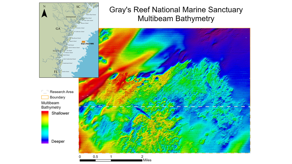
An additional resource collected from multibeam technologies is backscatter. Backscatter measures the intensity of the sound echoes reflected back to the sonar transducer. This provides information on the geological makeup of the seafloor and the objects on it. For example, hard, rocky ledges reflect more sound than softer materials like sand. Multiple years of mapping the sanctuary led to a better understanding of how the sand bottom is constantly changing—exposing and covering hard bottom.
For more information on how multibeam technology works, please visit NOAA's multibeam website. To see how this habitat map was made, read this publication, Benthic Habitats of Gray's Reef National Marine Sanctuary.
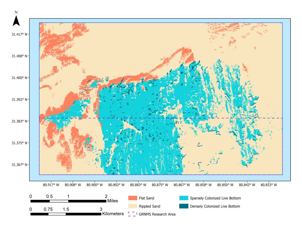
How is multibeam sonar used in the sanctuary?
High-resolution maps of the sanctuary support resource protection, research, and policy and management decisions at Gray's Reef National Marine Sanctuary. The natural shapes and features of the ocean floor support the diverse marine life found at Gray's Reef. Tall sandstone ledges covered in invertebrates and deep overhangs where fish, sharks, and turtles take shelter provide different habitats suited for life on the seafloor. This information is used to make more informed decisions for implementing sustainable policies. Research projects conducted at Gray's Reef National Marine Sanctuary often refer to the multibeam and habitat maps to better understand the distribution of bottom life and other species in relation to their habitat. Researchers aim to protect essential habitats and be able to address other spatially explicit management goals.