Research Area
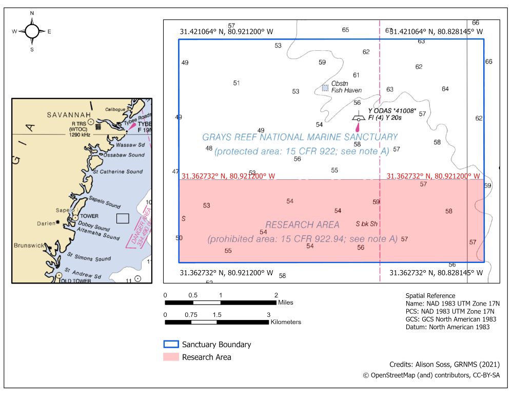
The southern third of Gray's Reef National Marine Sanctuary is a research only area. Scientists use the research area to study the impact of human activities on the sanctuary's marine resources such as bottom fishing. The research area provides a place to monitor and study impacts of natural events such as hurricanes and droughts.
Fishing and diving are prohibited in the research area. Vessels are allowed to travel across the area as long as gear is stowed properly onboard and the vessel does not make any stops.
Read the full 2020 report about scientific research in the research area.
Established in December 2011, the approximately eight-square-mile area is relatively free of human activity, allowing scientists to design and implement studies where variables can be controlled over long periods of time. To incorporate the research area into your scientific research, please see our permitting page.
Research Area Boundaries
| Latitude (DD) | Longitude (DD) | |
|---|---|---|
| Southwest | 31.362732° N | 80.921200° W |
| Northwest | 31.384444° N | 80.921200° W |
| Northeast | 31.384444° N | 80.828145° W |
| Southeast | 31.362732° N | 80.828145° Wt |
About the Designation
NOAA's Office of National Marine Sanctuaries received comments during a public comment period on the proposed research area from September to December 2010. The boundary option chosen for the research area was favored by most sanctuary users and was expected to displace a minimal number of sanctuary visitors. The research area designation went into effect on December 4th, 2011.