Location and Oceanography
Gray's Reef is situated on the mid-continental shelf along the South Atlantic Bight, a region of the Atlantic Ocean defined by a gradual bend in the coastline stretching from North Carolina's Outer Banks to Cape Canaveral, Florida.
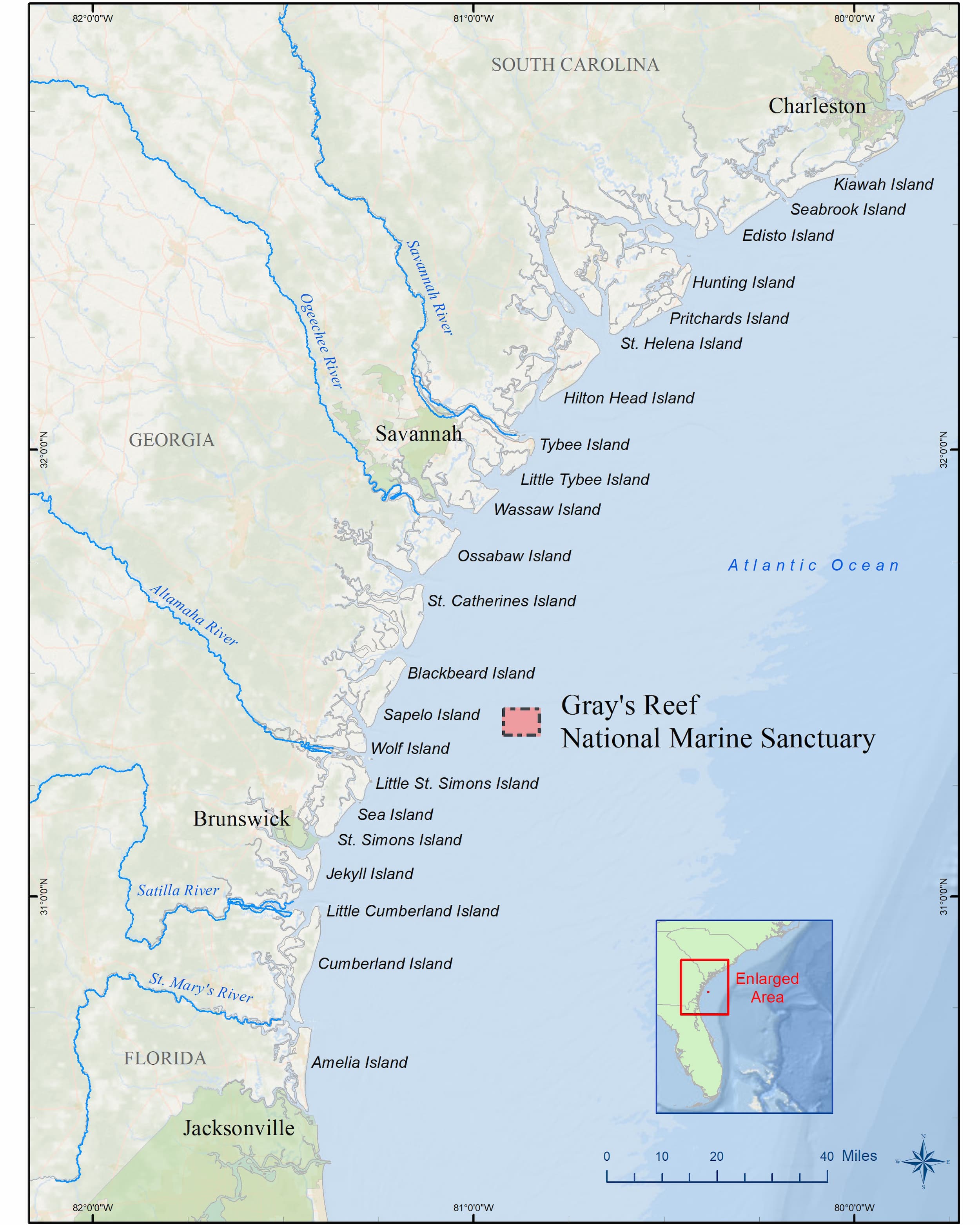
Gray's Reef National Marine Sanctuary is 19 miles due east of Sapelo Island, Georgia. Darien, Georgia is the nearest town, located in McIntosh County.
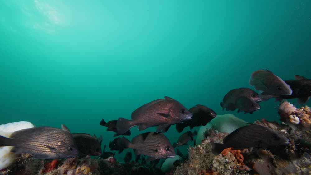
The waters of Gray's Reef National Marine Sanctuary and other live-bottom habitats along Georgia's coast are influenced by rivers, tides, and ocean currents. The combination of river, tidal, and ocean current make Gray's Reef a well-mixed habitat.
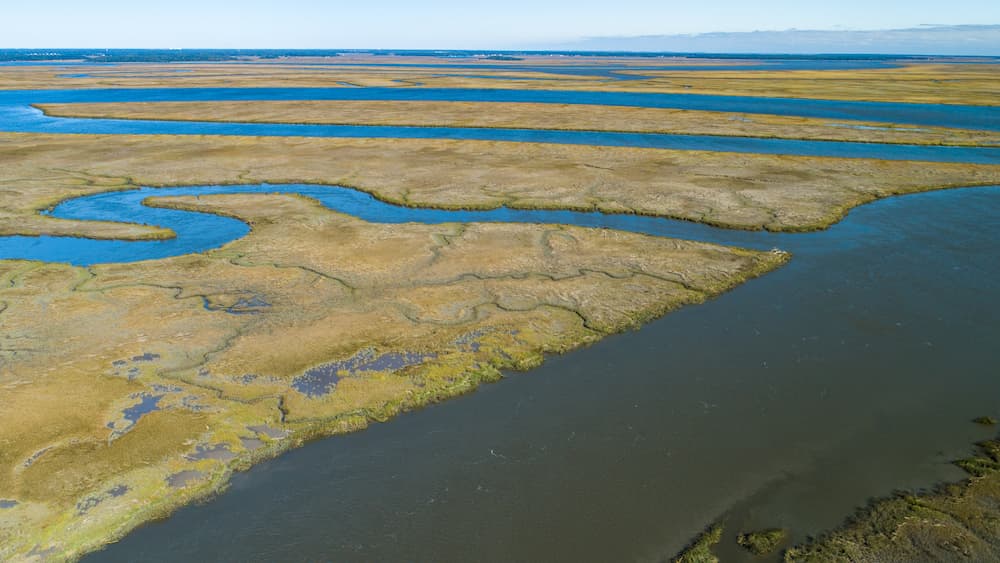
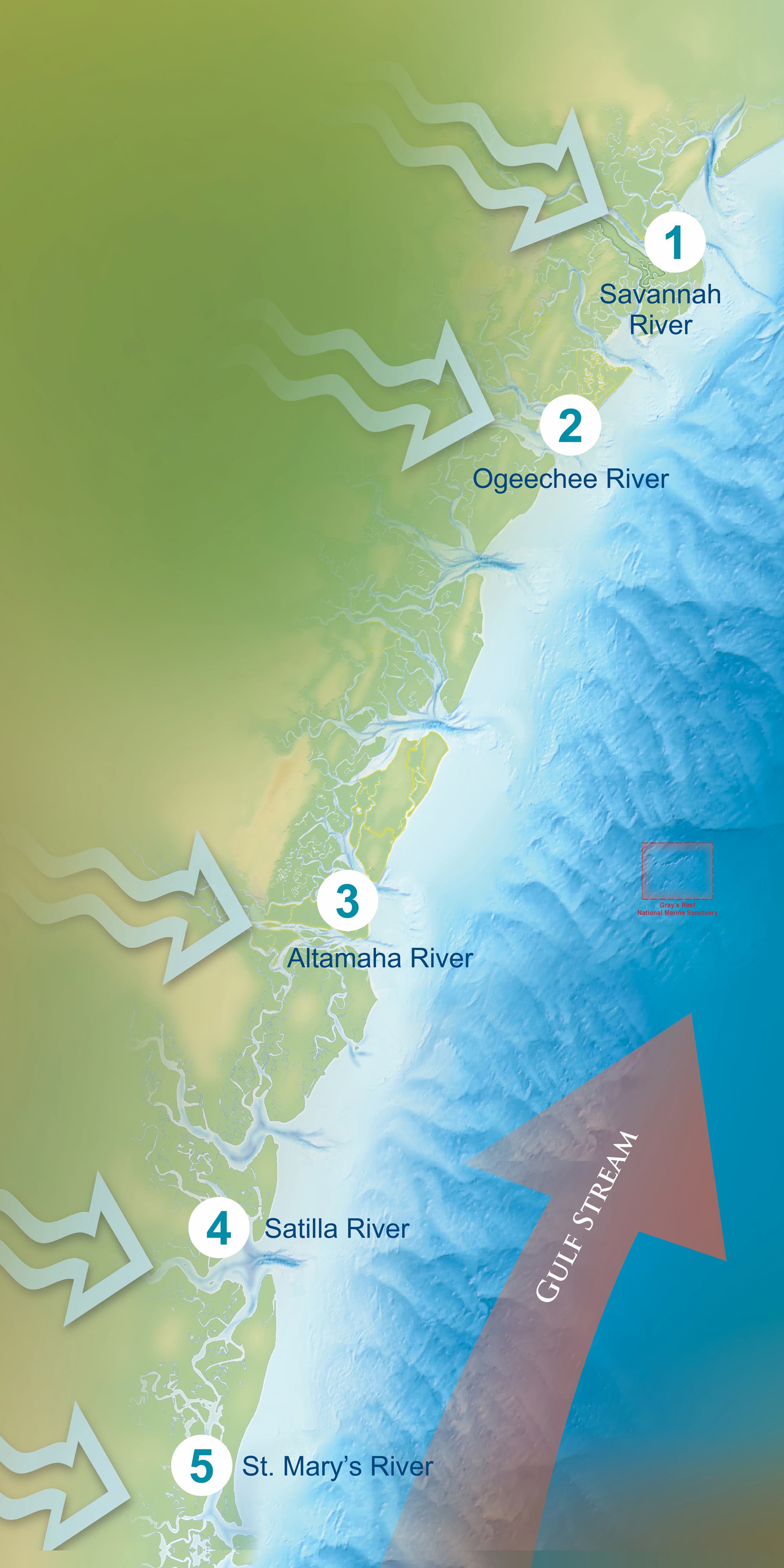
Five rivers stretch from North to South along the Georgia coast and discharge healthy nutrients, as well as harmful pollutants. These rivers include: Savannah, Ogeechee, Altamaha, Satilla, and St. Mary's. The mighty Altamaha River flows into the ocean closest to Gray's Reef, and its lush, protected salt marshes serve as nurseries to many animals found at Gray's Reef.
Tides along coastal Georgia and most of the East Coast of the United States experience semidiurnal tides—two high tides and two low tides per day. The average tidal range in Georgia of 7 feet results in large volumes of water moving daily from the coastal marshes and rivers to offshore habitats and mixing throughout this movement. View the NOAA current weather conditions in the sanctuary and nearby tides.
The Gulf Stream is the major ocean current influencing Gray's Reef. This warm water current brings waters from the Caribbean and Gulf of America up the East Coast of the United States and Canada. The Gulf Stream flows strongest approximately 70 miles east of Gray's Reef, but its strength still influences the marine life and nutrient levels found along coastal Georgia.
The sanctuary has no surface buoys marking the boundaries of the sanctuary or its research area. Boundaries of the sanctuary are indicated on digital and printed navigation charts .
The only navigational aid in the sanctuary is the National Weather Service Station 41008 located at 31.400° N, 080.866° W.
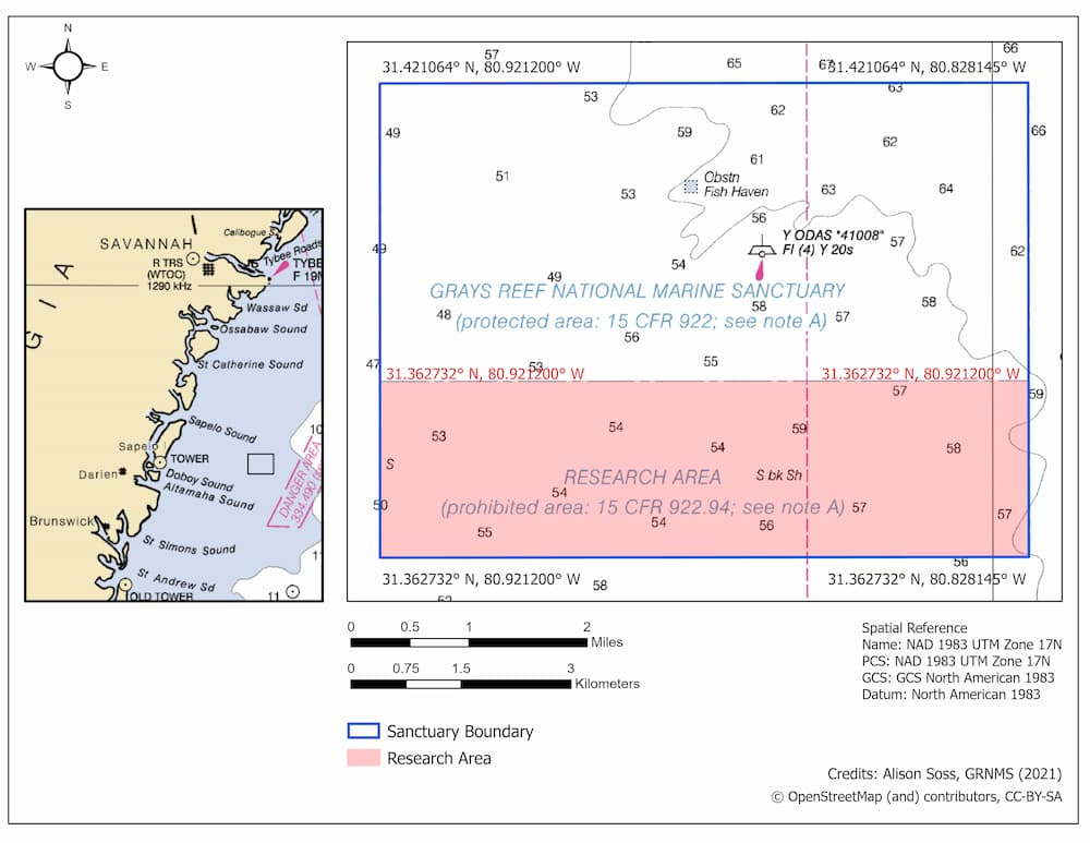
| Latitude (DD | Longitude (DD) | |
|---|---|---|
| Southwest | 31.362732° N | 80.921200° W |
| Northwest | 31.421064° N | 80.921200° W |
| Northeast | 31.421064° N | 80.828145° W |
| Southeast | 31.362732° N | 80.828145° W |
| Latitude (DD | Longitude (DD) | |
|---|---|---|
| Southwest | 31.362732° N | 80.921200° W |
| Northwest | 31.384444° N | 80.921200° W |
| Northeast | 31.384444° N | 80.828145° W |
| Southeast | 31.362732° N | 80.828145° W |