Diving at Gray's Reef
Gray's Reef National Marine Sanctuary provides advanced scuba divers the opportunity to explore the ledges, plateaus, and undercuts of live-bottom habitats common throughout the South Atlantic Bight. Marine life seen while scuba diving includes schools of fishes, hundreds of species of invertebrates, sea turtles, and sharks.
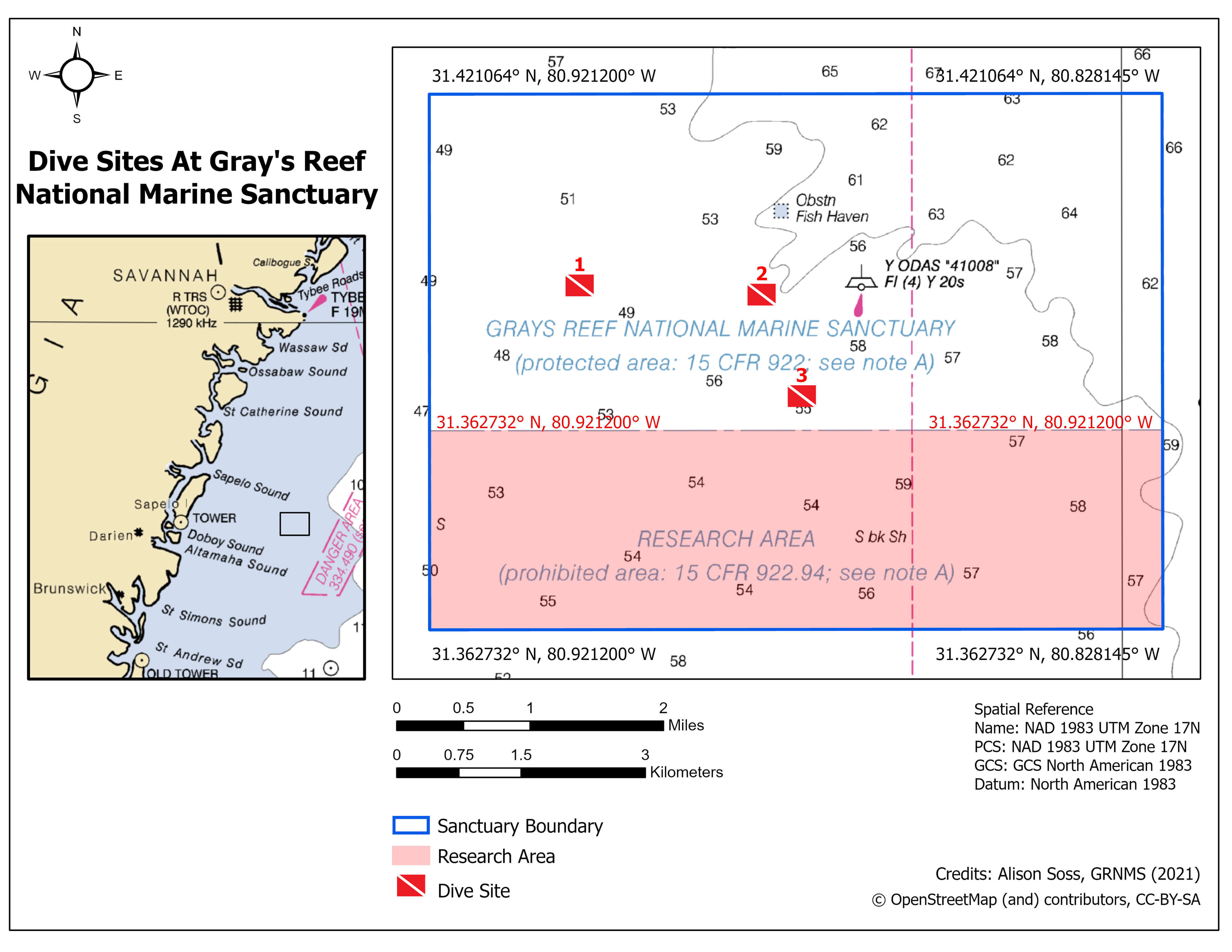
The dive sites below are a great start for divers visiting the sanctuary.
| Above map site number | Latitude | Longitude | Site Features |
|---|---|---|---|
| 1 | 31.39905° N
31° 23'56.58" N |
-80.90212° W
80° 54'7.632" W |
Extensive hard bottom with nooks and crannies |
| 2 | 31.39803° N
31° 23'52.908" N |
-80.87903° W
80° 52'44.508" W |
Ledge with smaller undercuts, research acoustic receiver, several overhangs |
| 3 | 31.386967° N
31° 23'13.0812" N |
-80.873933° W
80° 52'26.1588" W |
Sponge field, tabletop ledge with deep undercuts |
If you visit one of these dive sites and would like to share photos with the sanctuary, please email us at graysreef@noaa.gov.
Get Into Your Sanctuary Photo Contest - NOAA's Office of National Marine Sanctuaries hosts an annual photo contest from Memorial Day weekend to Labor Day weekend.